
Genevieve Explodes into a Major Hurricane
Rapid Intensification Underway in the Eastern Pacific

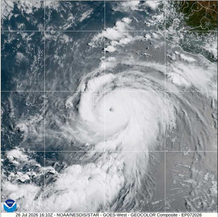
Genevieve has undergone a dramatic transformation, rapidly intensifying into a powerful major hurricane over the past 24 hours.
Current Status and Statistics
Position: 13.4°N, 109.4°W (as of 1500Z)
Initial Intensity: 105 knots (120 mph) — a Category 3 major hurricane
Movement: West-Northwest (WNW) at 14 knots
Recent Trend: Intensified by an astounding 55 knots over the past 24 hours.
The Forecast: Continued Rapid Intensification
Genevieve is not done growing. Environmental conditions remain exceptionally favorable for additional rapid intensification over the next 24 to 36 hours:
Sea Surface Temperatures: Very warm.
Wind Shear: Low.
Upper-level Divergence: Strong.
SHIPS Rapid Intensification (RI) guidance indicates a high probability of at least another 20 knots of strengthening in the next 24 hours. The official National Hurricane Center forecast brings Genevieve up to a dangerous 130 knots (150 mph) by Monday night/Tuesday morning. Given how primed the atmosphere and ocean are, peak intensity forecasts could turn out conservative.
Hurricane force winds currently extend outward up to 40 nm north of the center with 50 knot winds outward up to 70 nm. Significant wave heights are estimated to be up to 10-11 meters (32-36 feet)building up to 13-14 meters (43-46 feet).
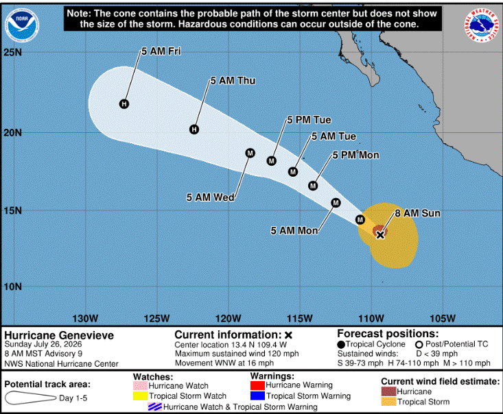
By mid-week, the storm will begin tracking over cooler waters and encountering a more stable environment, initiating a steady weakening trend. However, current models project Genevieve to maintain hurricane status all the way through Day 5. Genevieve is currently cruising west-northwestward at a brisk 14 knots but by early this week, the system is expected to decelerate.
NHC advisories: NOAA NHC