
Hurricane Fausto Central Pacific Update
Fausto has officially crossed into the Central Pacific

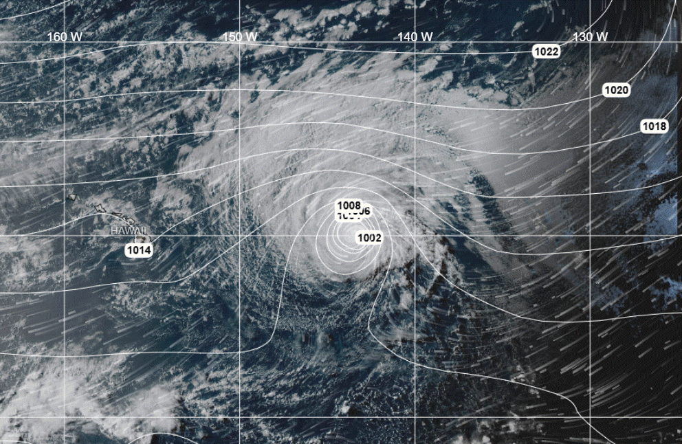
Hurricane Fausto has officially crossed into the Central Pacific Basin as the system moves generally westward to west-northwestward at approximately 12-14 knots. It is generating significant wave heights of up to about 8 meters (26 feet).
Current Storm Parameters
Current Maximum Sustained Winds: 75 knots (approx. 85 mph)
Radius of 64-kt (Hurricane-Force) Winds: Extending outward up to 35-40 nautical miles (NM) from the center, predominantly in the northern semicircle.
Radius of 50-kt Winds: Extending outward up to 70 NM from the center (largest in the northwest quadrant).
Radius of 34-kt (Tropical-Storm-Force) Winds: Extending outward up to 180 NM from the center.
Closest Point of Approach (CPA) to the Hawaiian Islands
Current forecast tracks keep the center of Fausto north of the Hawaiian archipelago. The Closest Point of Approach (CPA) is projected to be approximately 145 nautical miles (165 statute miles) North-Northeast of Hilo, Hawaii, occurring between Tuesday night and Wednesday (July 28–July 29, 2026).
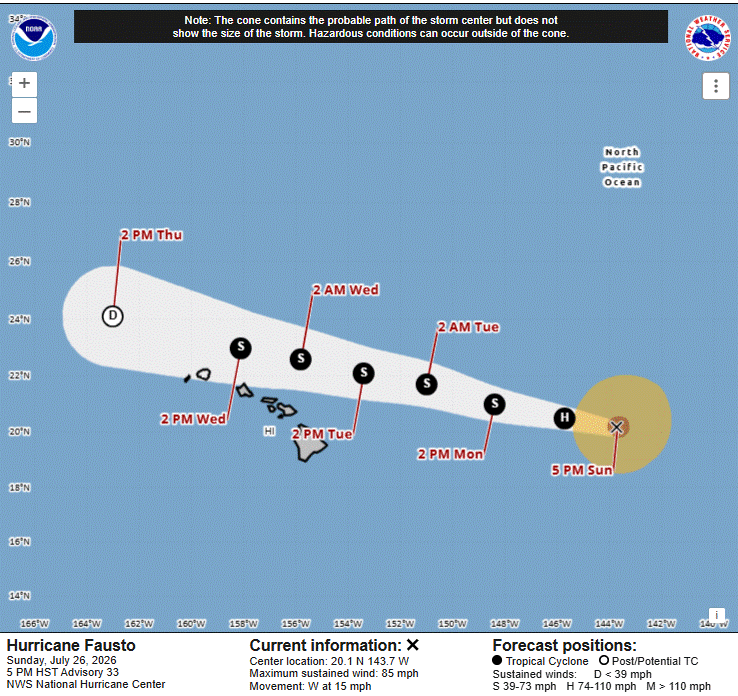
Fausto is forecast to slowly weaken as it encounters drier air and increased wind shear displacing the deepest convection and strongest winds to the north of the center.
NHC advisories: NOAA NHC