

PACIFIC STORM ALERT: TD 12W
Forecast to Reach Super Typhoon Status

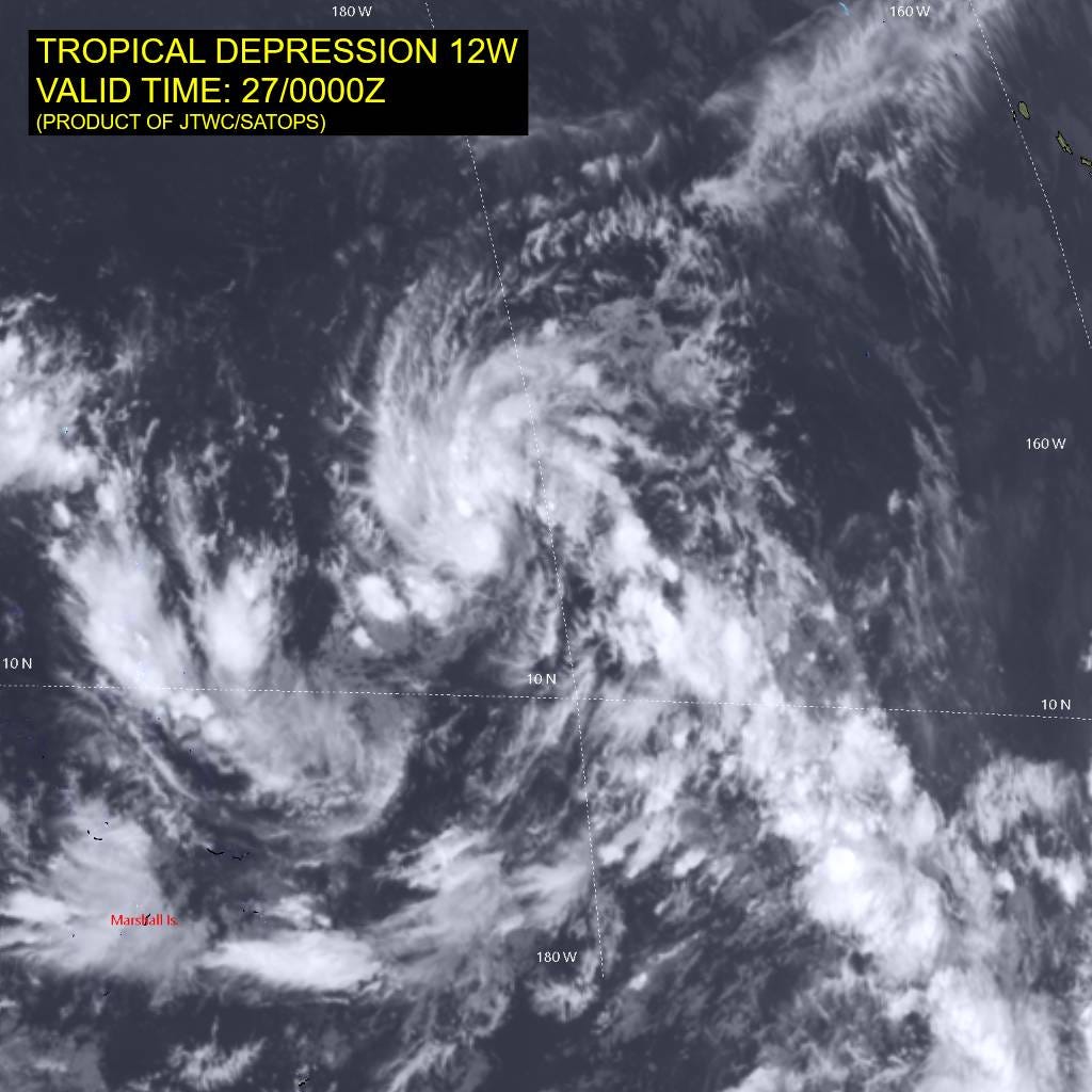
Tropical Depression 12W currently has max winds of 30 knots, however, the environmental conditions are primed for Rapid Intensification (RI). The JTWC is forecasting TD 12W to reach Super Typhoon strength by the end of the week.
Current Position and Status
TD 12W is consolidating roughly 540 nautical miles northeast of Majuro.
Coordinates: 12.8N 178.3E
Current Winds: 30 knots (the wind field is currently asymmetrical, with the strongest winds isolated to the northern semicircle)
Movement: Westward at 14 knots
Seas: Significant wave heights are already reaching 4 to 4.5 meters.
Track Forecast: West to Northwest
For the next 36 hours, expect the system to continue its westward track, steered by a subtropical ridge situated north of Wake Island. After this initial period, TD 12W will take a more northwestward trajectory over the following five days.
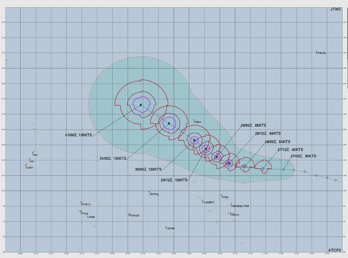
The Primary Threat: Rapid Intensification
Over the next 24 hours, the storm will steadily organize and its wind field will become more symmetrical. Once that structure is established, it will hit a pocket of near-perfect meteorological conditions:
Warm Sea Surface Temperatures: 29-30°C (84-86°F) provides massive thermal energy.
Low Vertical Wind Shear: Only 5-10 knots, meaning the storm’s vertical structure won’t be torn apart.
Strong Outflow: Excellent ventilation aloft will exhaust air out of the system efficiently.
Driven by this highly favorable environment, TD 12W is forecast to undergo Rapid Intensification, reaching Super Typhoon strength by July 31st (31/0000Z) with max winds to about 130 knots with hurricane force winds extending out up to 50 nm and 50 knot winds out to 80 nm. While track confidence is high, forecasting the exact peak and timing of Rapid Intensification carries inherent uncertainties. Some aggressive weather models are suggesting wind speeds could reach 150 knots by day five.