
Tropical Update forAtlantic Basin
Atlantic Tropical Basin shows some signs of activity

Tropical Waves (Atlantic & Eastern Caribbean)
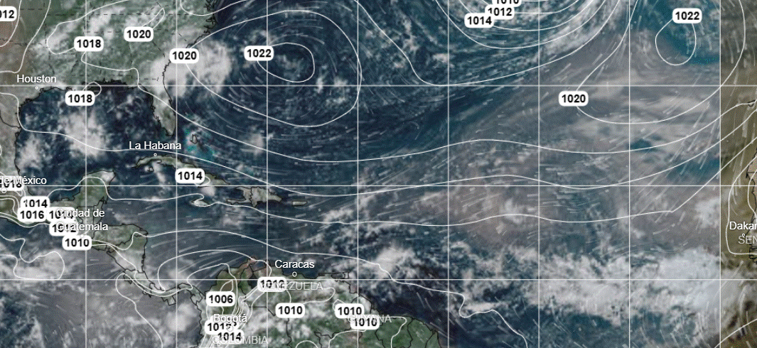
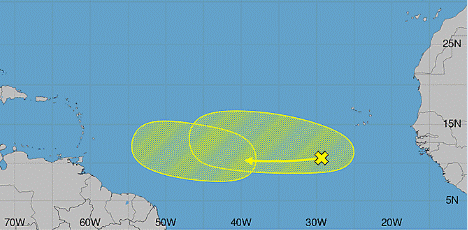
Wave 1 (Cabo Verde / Eastern Atlantic): Axis along 29W (06N to 19N), moving West at 10–15 knots.
Wave 2 (Central Atlantic): Axis near 40W; broad cyclonic circulation near northern end.
Wave 3 (East of Lesser Antilles): Axis along 59W/60W (05N to 20N), moving West at 10–15 knots.
Some gradual development is possible for waves 1 and 2 during the early to middle part of next week while the systems move westward. Upper-level winds are expected to become much less conducive for development later in the week. NOAA NHC currently gives these waves a slight (20-30%) risk for developing into a tropical cyclone.
Gulf
Shower Activity:
Showers and thunderstorms between 23N–27N / 87W–94W.
Scattered showers and thunderstorms expected through the afternoon in the eastern Gulf as well as the Bay of Campeche and SW Gulf.
Caribbean
Shower Activity:
Scattered showers and thunderstorms located between Cuba and Jamaica, across the Cayman Islands, and south of western Cuba (including the Yucatan Channel).
Tropical Waves: Tropical wave extends along 59W/60W impacting the far eastern edge/Lesser Antilles.
Wind Speed & Direction:
South-Central & SW Caribbean: Fresh to strong trades with gale-force winds occurring tonight offshore Colombia and strong to near gale-force winds in the Gulf of Venezuela each night.
Southwest Atlantic
Shower Activity:
Scattered showers and thunderstorms active north of the Bahamas and west of 75W (shifting NW and persisting north of 30N through Sunday).
Note: Widespread Saharan dust continues over the Atlantic and Caribbean Sea, heaviest east of 60W.