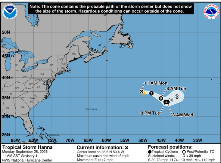

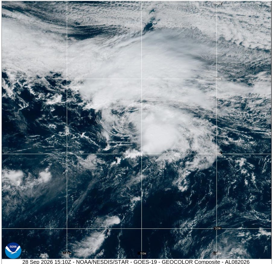
The disturbance previously tracked over the central subtropical Atlantic has acquired a well-defined surface circulation and center.
Current Status (1500 UTC (1100 AM AST), Mon Sep 28
Center Location: 36.6N, 50.4W (Accurate within 25 NM)
Present Movement: East (100 degrees) at 15 knots
Wind & Pressure Profile
Maximum Sustained Winds: 40 knots
Peak Gusts: 50 knots
Estimated Minimum Central Pressure: 1006 MB
Max Significant Wave Height: Estimated 4-4.5 meters (13-15 feet)
Wind Field
The strongest winds (35 to 40 knots) and deep convection are located to the east and southeast of the center, largely due to strong westerly shear. Currently, 34-knot tropical storm-force winds extend out about 80 nautical miles strictly into the southeastern quadrant..
Outlook
Hanna is expected to slow after about 24 hours, then turn toward the east-northeast. Strong west-northwesterly shear is expected to persist over the storm for the next several days, meaning little, if any, strengthening is anticipated. Within a couple of days, Hanna is expected to degenerate into a post-tropical remnant low.